Yves here. It’s COLD here. 12 degrees and windy! But no snow and just a little rain before the 40 degree temperature drop in a bit over 6 hours. And you?
By Bob Henson and Jeff Masters. Originally published at Yale Climate Connections
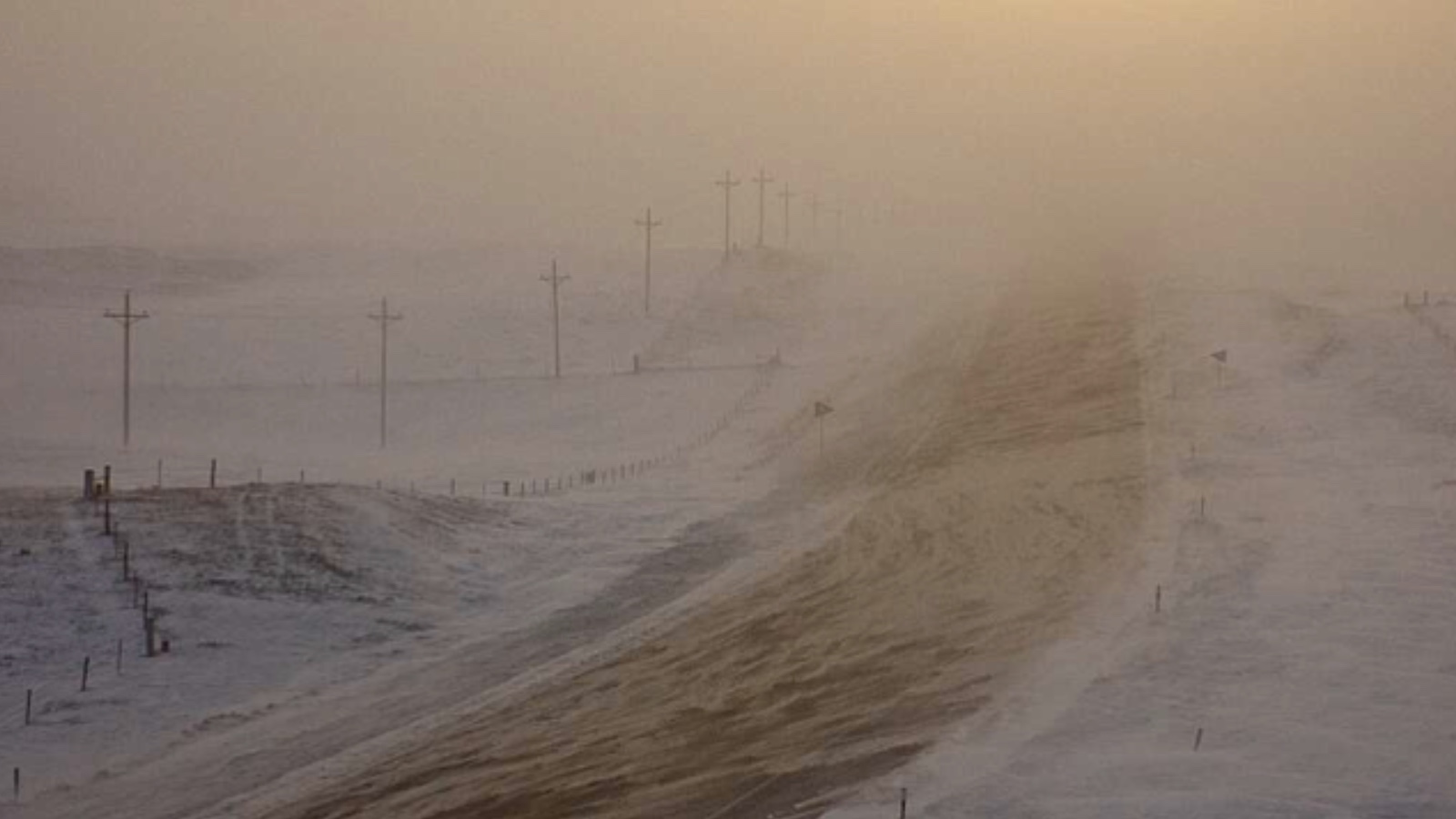
Life-threatening situation on I-25 between Wellington Colorado and Cheyenne Wyoming as a blinding whiteout grinds the interstate to a standstill in -30 to -40 windchills. If you are stuck in this absolutely do not turn your car off! Stay warm! @NWSCheyenne @NWSBoulder #cowx #wywx pic.twitter.com/SW98Vha8nB
— Michael Charnick (@charnick_wx) December 22, 2022
Along the cold front, a powerful low-pressure center will intensify over southern Ontario and Quebec from Friday into Saturday. The circulation around this “bomb” cyclone will lead to massive lake-effect snow and lakeshore flooding in New York and will help drive what could be the worst coastal flooding in 40-plus years in parts of Maine (see below).
Southeasterly wind gusts of 100 to 150 mph are expected on Friday at the summit of famously weather-beaten Mount Washington, New Hampshire.
When the Bottom Drops out of the Thermometer
Stunning temperature falls – in some areas exceeding 40°F in an hour and 70°F in 24 hours – swept through the High Plains late Tuesday.
How much did the temperature change in an hour or less as the cold front passed? Here is a graphical depiction using the real-time mesoscale analysis grids. The grid showed max drop was near -47 degrees in NE Colorado. Included is the actual record drop trace at Cheyenne, WY. pic.twitter.com/ct47GE2ppo
— NWS Weather Prediction Center (@NWSWPC) December 22, 2022
At least two National Weather Service offices reported their largest one-hour drops on record: Cheyenne, Wyoming (at least 41 degrees Fahrenheit, from 43°F to 2°F between 1:05 and 1:53 p.m. MST) and Denver, Colorado (at least 37 degrees Fahrenheit, from 42°F to 5°F between 4:53 and 5:53 p.m. MST). Both records are apparently based on 5-minute data from automated stations going back only several decades, whereas weather has been observed on at least a daily basis in both cities since 1872.
Denver bottomed out at -22°F on Wednesday morning, the city’s coldest reading on any date since -25°F on December 22, 1990. It’s also the coldest ever measured at Denver International Airport, which became Denver’s official reporting site with its opening in 1995.
Less dramatic but still impressive short-term temperature crashes were spreading across the Southern Plains on Wednesday. The Dallas-Fort Worth International Airport went from 42°F at 8 a.m. CST to 20°F with light snow at 11 a.m. CST.
Good morning from a bitterly cold and snowy #okc #oklahoma this morning. #okwx pic.twitter.com/KHgXcGrNqo
— Bobby Johnson (@wx_okla) December 22, 2022
Has an Arctic cold front ever looked this fascinating from space? I think not. pic.twitter.com/rOsrtebXxu
— Andrew Freedman (@afreedma) December 22, 2022
#Snow forecast for Lower Great Lakes. Combine this with 50+mph wind gusts and temps dropping into the single numbers, this becomes a dangerous #blizzard for #Buffalo and #Watertown Friday through Saturday. Please stay home if you can until conditions improve. #weather pic.twitter.com/lVwRIIaDV5
— Tom Niziol (@TomNiziol) December 22, 2022
Buffalo Braces for a Blizzard with Near-Record Lake Erie flooding
The ferocious winds of the blizzard will create huge waves of 15-20 feet on all of the Great Lakes, causing damaging shoreline flooding and dangerous conditions for shipping. The highest danger of flooding lies on New York’s east shore of Lake Erie in Buffalo. The mighty winds of the blizzard are predicted to blow at 35-55 mph from the southwest along the length of Lake Erie on Friday and Saturday, causing waves on the lake to peak Friday afternoon through Saturday morning at 15-20 feet.
The incredible Significant Wave Height forecasts for all of the Great Lakes over the next few days are driven by the strong and persistent winds from the developing winter storm. Pink colors are significant wave heights approaching 20+ ft.
Link to maps:https://t.co/eXiO9Gi8Ef pic.twitter.com/uYju0DfC0l
— Dr. Alicia M Bentley (@AliciaMBentley) December 22, 2022
Not only will these winds deliver heavy lake-effect snow, they will also pile up Lake Erie’s waters along the eastern shore and cause major flood problems in Buffalo and Niagara Falls. According to the Buffalo National Weather Service, water levels in Buffalo are expected to reach 12 feet above the normal low water level sometime between Friday afternoon and Friday night, challenging the record of 12.08 feet set on December 2, 1985.
Model forecast for Lake Erie Water Level for Friday at 4PM. Note, the seiche level exceeds the key. Buffalo will rise above 10 feet and #Toledo will drop ~ 5 feet. Hard to imagine a 15 foot difference from one end to the other. #winter @NWSBUFFALO @NWSCLE pic.twitter.com/6Ox69a6Rz5
— Tom Niziol (@TomNiziol) December 22, 2022
High winds with gusts of 55-70 mph will be accompanied by heavy snow of up to three feet, wind chills of 10 to 20 below zero, and near white-out conditions, making travel difficult to impossible. Power outages will be a major concern.
Coastal flooding and big waves for the Northeast U.S. and Nova Scotia
A coastal flood warning is up for the coasts of New Hampshire and western Maine, where southeasterly storm-force winds of 60-65 mph are expected on Friday and Saturday, bringing waves of 15-20 feet and a storm surge of about three feet to the coast.
Water levels at the coast are expected to approach the highest levels of all time, set during the Blizzard of 1978. The National Weather Service is warning of moderate coastal flooding, with a few pockets of major flooding. This will cause a significant threat to property, with many coastal communities experiencing damage and flood waters extending well inland in riverine tidal areas. A few evacuations may be needed in the most vulnerable areas. Communities with a southeast exposure such as Hampton, New Hampshire, may be particularly hard-hit with the potential for up to three feet of water.
Portland, ME predicted to get a 3′ storm surge near the time of high tide Fri morning, with moderate flooding and some pockets of major flooding. This would be the 3rd-highest water level on record behind the Blizzard of ’78 (Feb) and a Jan 1978 nor’easter. Records since 1912. pic.twitter.com/yZS8niAPUP
— Jeff Masters (@DrJeffMasters) December 22, 2022
A coastal flood warning is also in effect for portions of Rhode Island and Massachusetts, where water levels 1-2 feet above ground level will cause mostly minor flooding during the Friday morning high tide. Waves 15-20 feet high are predicted for the offshore waters of Nova Scotia, Canada, on Saturday, when the potential for damaging storm surge flooding is expected during the high tide cycles.
On the east shore of Chesapeake Bay, Maryland, one tide gauge is predicted to exceed the major flood threshold during the Friday afternoon high-tide cycle. Minor to moderate coastal flooding is predicted along the shores of Delaware, New Jersey, New York, and Connecticut during the Friday morning high-tide cycle.
Records Won’t Do Justice to This Cold Wave
Given the startling intensity of this Arctic blast, it’s counterintuitive that it might end up generating only a modest number of record lows. Here’s why: At many locations east of the Rockies, the most intense pre-Christmas cold wave on record peaked during this same time period in 1983. Driven by the strongest high-pressure center ever recorded in the contiguous U.S. (1064 mb at Miles City, Montana), that cold wave shattered daily and monthly records across the central and eastern United and helped make that month the coldest December in U.S. history, with an average temperature of 25.47 degrees Fahrenheit.
In contrast, temperatures averaged across the whole contiguous U.S. weren’t running far from normal through December 21. A quick post-frontal warm-up should push most of the nation above average once again over the last few days of this month.
As noted at Eye on the Storm on Monday, the strength of this Arctic high could manage to produce a few all-time record lows in places where clear, calm conditions prevail overnight atop snow-covered land directly beneath the high. That’s just what happened in Casper, Wyoming. Temperatures in Casper dipped to –42°F early Thursday, breaking the city’s all-time record low of –41°F set on December 21, 1990. Records in Casper date back to 1939. (The airport at Riverton, Wyoming, also set its all-time low with -31°F, but that station database goes back only to 1995.)
The Casper reading is the year’s first all-time low at any U.S. weather station with a long-term period of record, according to weather records expert Maximiliano Herrera (@extremetemps). In contrast, at least 14 long-term U.S. stations have set all-time highs this year.
Website visitors can comment on “Eye on the Storm” posts (see comments policybelow). Sign up to receive notices of new postings here. Please direct media inquiriesfor Eye on the Storm’s Dr. Jeff Masters or Bob Henson here.

I-25 follows roughly along up and down the state to the east of the Front Range, but in the north end of the state around Wellington the Front Range curves off to the NW, and that’s when Northern Colorado experiences Wyoming’s persistent wind, or in that case ‘howling wind’. When the wind is really driving snow across the freeway, they close that stretch. Also between Cheyenne and Laramie, considered one of the most dangerous bits of road in the U.S., especially for big rigs and RV’s.
Great memories, Lexx! A few months after we moved to Denver, we headed north towards Wyoming on I-25 on our way to Seattle for Christmas. Our little Chevy S-10 pickup, great for that SoCal weather, spun out on the icy surface and we ended up facing south on the median. I sat there for a few minutes, running through in my head what could have happened if one of those giant 18-wheelers and been behind us. And, then we bought an all-wheel drive Subaru when we returned to Denver.
A few years later, in Wyoming, near the Montana border, on our way to Glacier NP, a gust of ‘howling wind’ hit the Subaru, and it flipped over …. and over …. and over, landing right side up going south, on the side of the Interstate. I reviewed again what could have happened if a giant 18-wheeler had been close by. We bought another Subaru, one with a lower profile and less wind resistance.
Before we sold our little travel trailer, we took it for one last trip down to Santa Fe. New Mexico state patrol closed I-25 that afternoon because of the wind storm hitting the northern part of the state. We sat for hours with dozens of other vehicles and when the patrol let us go, we headed south again, and saw along way the remnants of why they had closed the freeway. Lots of big rigs, travel trailers and one 5th wheel completely totaled, the parts and personal belongings scattered.
In September we replaced the trailer with a 5th wheel that is 14 ft. longer, and much taller… but it was really the weight of the thing that filled me with caution. I looked my husband dead in his eyeballs and said, ‘We will not be traveling in high winds in this thing; we’ll be parking it for the night until conditions improve.’ Then he said, ‘I’ll be doing all the driving.’ Which is couple-speak for acknowledging to each other that the new-to-us toy made us nervous and we have no appetite for risky behavior in our old age. Zippo, zilch, nada, filled with nope.
I lived in Colorado for a few years when I was little and used to get scared by that wind sometimes. So my dad made up a story to tell me when I was scared, about how one day I went up into the mountains to figure out where the sound was coming from and I found the wind caught in some thorny shrubs crying and howling. I helped free her from the branches and they she flew me down the mountains and over our town and safely home.
Superb, thank you!
It’s a blast alright, Crown Point, east of Portland Or clocked 86mph (when the sensor broke) east winds howling down the Columbia Gorge into the Willamette Valley and Portland metro spraying Siberian sub-zero temps. This bomb cyclone is more of a temperature and wind event than precip. Could be a winter wheat killer with no snow cover in virtually all of Kansas, Oklahoma, Texas winter wheat areas, of course as every winter wheat farmer, trader, enduser ever knows, it won’t matter until spring thaw. Livestock herds and wildlife threatened by brutal temps and winds.
Its quiet and quite nice on the left coast, bottom corner pocket…
But then a couple of atmospheric rivers show up early next week and it all depends on whether its a rain on snow event or snow on snow, and the first storm is a warm one so it could melt out an awful lot of snow on the ground already, and either way it’ll fill up reservoirs big time, so there’s that.
Its awfully similar to last years ‘Santa Storm’ which deposited 10 feet of snow in the higher climes-but more warm.
And I thought that our low temperature of 56ºF this morning here in Baja California Sur was brutal.
Well, it is brutal if all you’re wearing is sandals and shorts!
Central Montana is already starting to warm up. -15 F this morning, a 15 degree improvement over yesterday. Was amazing to watch the bird feeder the last few days. Our resident flock went through about a weeks worth of feed and suet in two days.
Tomorrow we’ll be back to our more seasonal weather, 38 degrees and 20 mph winds. I hear Colorado is nice….
Edmonton has warmed up from several days below -35 C / – 33 F to this morning’s -25 C / -13 F, before windchill. Not unusual for Prairie winters, but that doesn’t mean it’s enjoyable.
The local birds seem to lie low during times of intense cold like this.
There’s a winter storm making landfall on the BC coast today, and my friend has just decided his planned family trip to Disneyland will have to go by road, as airport cancellations start to stack up (all across the country).
I did not know so much of the US was also experiencing such a cold snap. Stay safe out there!
It was -11 when I woke up this morning; it’s up to zero now. The birds at our feeders and suet have been chowing down here as well, pretty much eating continuously to stay warm. Husband went out before sunset yesterday to refill them knowing they’d show up at first light. Our forecast high today is 13, for Christmas Day it’s the high 40’s.
Personally I like cold weather, but Montana at -30? Nay. Sympathy for the folks in Pine Ridge.
We’re to have a high of -1 today with winds from the WNW at 26mph. Driving is treacherous on some stretches of highways and travel is not recommended. Last year we had a high of 42 and sunshine. I remember because this is the anniversary of my trip around the sun. It is also Harry Shearer’s:)
Happy Birthday!
Sit rep from the south shore of Superior: so far, meh. The wind is here and the temps range from 11-9 (true temps) depending on elevation. We got handful of inches yesterday but the snow so far and the temps are really just winter here. It seems like the lakes are providing a bit of a protective bubble and may be helping to force the front to the south. Now those in the far lee of the lakes will probably get hammered. I’ve definitely seen the Marquette surfer contingent prepping for those waves. This is really the only time of the year you can surf on Superior (and it still requires a good storm coming).
On the flip side, my new driver niece attending university up here and experiencing her first winter living off campus, driving and working has gotten stuck in the center of a roundabout (yesterday) and then stuck in her alley (this morning). So rescue uncle is paying the price of the weather to some degree.
It’s been in the 30’s here in San Diego County at night. Will warm up this weekend though. Christmas should be 75 degrees. Then “winter” hits – 8 straight days of rain – Hopefully it’s snow in the mountains and steady light rain here.
I’m 100 miles south of Lake Superior, in NW Wisconsin. It was -15º F last night, at 10am this morning its -9ºF, with 30 mph winds, gusts to 45mph. There’s about 2 feet of snow on the ground and its drifting.
From the looks of a national weather map the worst of this storm is going to be to the south and just west of me.
Fingers crossed that the power doesn’t go out.
I feel bad for anybody who has to go out and work in this stuff. Really glad I don’t have animals that need feeding and watering right now.
It was “only” -4 here last night in central WA but a breeze put the wind chill factor at -20. We had a lost cat come onto our porch crying in the cold so we let her in the house and gave her a meal as the temperatures could be deadly even for furry critters. Our cat Suki is not happy about having an interloper around.
mpls./st. paul, last night at least -12, a toasty -2 today, the sun is out for a while, winds picking up! stay warm!
We are about 20 km west of the Lake Huron coast near Port Elgin, Ontario. The wind is 35 km gusting to 70 km in heavy blowing snow. Blizzard warnings are out for today and tomorrow morning. Temperature is about -1 deg C with a windchill of about -8 deg C and expected to fall overnight.
No roads are closed yet but Highway 21 will probably close later tonight.
The power has flickered on and off a few times so I have the generator set up and ready to go.
We get storms like this twice or maybe three times a year with a lot of lake effect snow in between as well. Our county snow removal crews are pretty good.
So far, it is not too bad yet.
Take care everyone!
In louisville ky at 3:00 PM. It is 1 degree. Woke up at -5 this morning. About 4 inches of snow. Extremely cold and windy last night. The wind gusts sounded like a jet plane right over the house. The temperature dropped here by about 30 degrees in a half hour. Never experienced anything like this before. We don’t have a lot of homeless here. But every available agency had people out in vans. Locating people and giving them a safe ride to a warm place for the night. The buses are free when ever we have a weather alert like this, so that people can get to a safe place. At least 3 more days before we even get out of freezer.
Yesterday ran in long sleeve quick dry shirt and got a little warm. This morning was in attic with hair dryer getting upstairs tub cold water line thawed. It was over about 4 hours but it was a 50 degree drop.
And I’m sure I 35 was worse, but I 71 was closed for hours between Louisville and Cincinnati today, cancelling my in-laws’ Christmas. Apparently a pile up caused semi trucks to idle and their brake lines froze. National guard towing took a while.
Prepped the camp stove, zippo hand-warmer, 4-season sleeping-bag system– just in case; covered the windows, and used a thermal sensor to find and block-off drafts.
Wind-chill is at least 30-below, so outside it’s still a bit chilly in coveralls, but my hands got pretty cold quickly. There’s a lot of USB rechargable heated clothing out there, but I have yet to invest in any.
It’s -8 here in northern Iowa. Wind chills put temps at -53. Not too much new snow, but lots of blowing of light fluffy snow. Blizzard warning in effect until 6:00 a.m. tomorrow. Stay warm everyone.
The ice started building up on everything yesterday around 1pm and the temperature was steady at 19F all day. Up to almost 1/3 inch of ice now at 1pm. The temperature is slowly rising today but still only 28F, ice continues to build. Supposed to rise above freezing later this afternoon and turn to rain but I remain skeptical.
Sorry, west Willamette Valley Oregon.
Here near the corners of AR, MO, KS and OK this is nowhere near the severity of December ’83. That front delivered nearly 2 feet of snow up front, temps dropped and i think it didn’t get above 3 for a high for something like 10 days or more. Power was out for a week. In town the water and sewer systems froze solid. Of course in the country we had no well without power. The only good thing about having 2 feet of snow outside. – water supply. Ponds froze 2.5 feet which had to be chopped with a pick axe morning and evenings for the horses water. We were in a large house with two fireplaces and a wood stove. Must have burned a rick of wood a day. And the entire family somehow managed to get to us for Christmas as planned. Placed great grandma in a rocker near the wood stove under so many blankets you could barely see her. Managed to keep everyone fed with great meals off that stove as well. Funny how the most difficult x-mas was the best ever.
This year it’s 1 inch of snow and about 36 hours of similar temps, no power or water loss, no horses and one fire to tend.
Here in Southeast Michigan over the last few days, the coldest it got was about 10 or so degrees. Mostly warmer than that.
Barely 2 inches of snow in total over the last few days.
Whenever I was awake to see or hear the wind, my feeling is the wind has been between zero and a light breeze.